


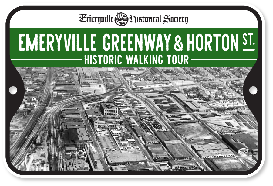
Emeryville Greenway & Horton St. Walking Tour
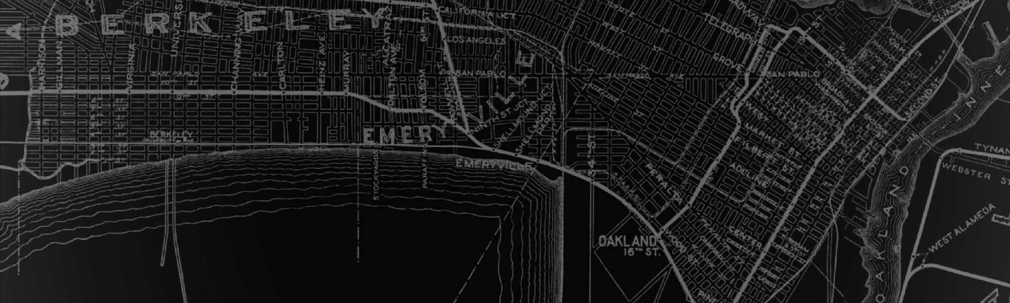
This self-guided walking tour traverses the Emeryville Greenway, a “rails-to-trails” project that converted parts of a former interurban passenger and freight rail line to a bicycle-pedestrian path.
The railway was originally built in 1911 and operated as part of Southern Pacific’s East Bay Electric Lines called the “Ninth Street Line.” Transit service ended in 1941 and Southern Pacific converted the line to a freight-only spur known as the “Ninth Street Drill Track.” Service on this freight line continued until 2001 when the North Emeryville area began rapidly transitioning from industry to residential use.
The abandoned spur was then acquired by the City of Emeryville who approved the North Hollis Area Urban Design plan in 2002. Segments of the trail were completed over the next two decades through private and public efforts. The final segment of the 1.3 mile path was completed as part of the Sherwin-Williams redevelopment project in 2023.
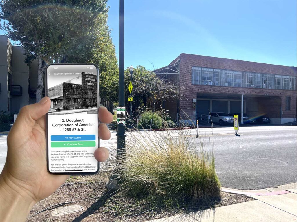
Take the tour on your mobile device by downloading the STQRY Guide App (previously “PocketSights”) through Apple App Store or Google Play.
- Download STQRY Guide app.
- Search “Emeryville.”
- Download & Start the tour (enable location feature for an optimized experience).
- Navigate to each stop.
Printable tour map below.
Fullscreen ModeThis tour sponsored by:

Emeryville Greenway & Horton St. Walking Tour
All stories written and edited by Rob Arias and Donald Hausler.
01 – The Marchant Building (Now Foundry31)
The northernmost part of The Emeryville Greenway, referred to by some locals as “Three Corners,” is the intersection of the cities of Emeryville, Berkeley and Oakland. A marker designates the spot where all three cities abut …
02 – The Geo. M. Martin Company (1250 67th Street)
The Geo. M. Martin Company is among the longest running family-owned businesses in Emeryville spanning three generations. Current CEO George R. Martin is the grandson of founder George M. Martin who started the company amid the Great Depression in 1929 …
03 – Doughnut Corporation of America (1255 67th St.)
This unassuming brick warehouse at the southwest corner of 67th St. and The Greenway was once home to a juggernaut in Doughnut mix manufacturing …
04 – Liquid Sugars Inc. (1245-1283 66th St.)
The Liquid Sugar Lofts are a 6-building, 55-unit housing complex completed in 2002 by the Pulte Group. Before this, it was home to Liquid Sugars Incorporated who were a family-run business that spanned four generations …
05 – Oliver Tire & Rubber (1200 65th Street)
The site of what is now the Oliver Lofts on 65th street was once the Oliver Tire & Rubber Company …
06 – Janson Iron Works / Baker Metal Products (1265 65th St.)
The Baker Metal building at 1265 65th St. is a relic of Emeryville’s industrial past that has remained relatively unchanged for the nearly 100 years of its existence. This will change in 2024 when construction on a long planned adaptive reuse project begins, just two years shy of its centennial …
07 – Peabody Lane
Originally known as “Peabody’s Lane,” Peabody Lane is among the most obscure, and oldest streets in Emeryville and North Oakland …
08 – J. T. Thorpe & Son, Inc. (1351 Ocean Avenue)
This building at 1351 Ocean Avenue on the corner of Doyle Street was built for the J. T. Thorpe & Son Company in 1945 …
09 – Pioneer Laundry (1291 63rd Street)
The two-story Emeryville Glen housing complex on the southeastern corner of 63rd and Doyle streets was once home to one of the largest, most modern laundry facilities in The East Bay …
10 – Forni Mfg. (Now Doyle Hollis Park)
The popular and well-trafficked Doyle Hollis Park in the center of Northern Emeryville is an anchor of this original section of Emeryville’s Greenway …
11 – International Harvester Co. (5900 – 6000 Hollis St.)
Located between 59th & 60th streets facing Hollis was a dynamo of American Manufacturing that spanned nearly a century …
12 – Emeryville Community Organic Garden
The original Emeryville Community Organic Garden, or “ECOG,” located at 59th and Doyle Streets was originally established in 1992. It was the first of what are now four community gardens scattered across the city …
13 – Liberty Iron Works Building (1301 59th St.)
This building on the corner of 59th & Doyle with the distinct art deco facade was originally built for Sacramento-founded Liberty Iron Works circa 1932 …
14 – Vernetti’s Town House (5862 Doyle St.)
You’d be hard pressed to find a place in Emeryville with more history packed into it as The Town House. The restaurant and bar has lived a storied life over its nearly 100 years of existence …
15 – Great Western Meter Company (1290 Powell St.)
The first record of this property at 1290 Powell Street is for the Great Western Meter Company in 1923 …
16 – Powell & Doyle St. Water Tower (1255 Powell St.)
The metal water tower here at the corner of Powell and Doyle streets might be considered a “landmark” within the city as Emeryville’s only standing water tower …
17 – The Pacific Manifolding Book Co. (5749 Doyle St.)
The brick facing you see here on the corner of Doyle and Powell streets is a portion of the original Pacific Manifolding Book Company that existed here from 1907 until the early 1980s …
18 – 1409/1411 Powell St. (Now Honor Kitchen & Cocktails)
According to county assessor data, the concrete, brick and timber-framed split-level structure at 1409 & 1411 Powell street was built in the 1920s amid the country’s prohibition years and listed in early Sanborn maps as a “restaurant” …
19 – Industrial Hard Chrome Plating Co. (5701 Hollis St.)
This 11,000 square feet concrete block structure at 5701 Hollis with the pyramid topped columns and ornate entryway was built in 1946 according to Alameda County assessor records …
20 – Southern Pacific East Bay Electric Lines
This stop on the tour recognizes what was once a major junction of the Southern Pacific electric railway that ultimately carved out the walkable path in Emeryville’s street grid that you are currently navigating …
21 – Marchant Calculating Machine Co.
The once vast factory that was the Marchant Calculating Machine Company has been whittled down to being nearly nonexistent over the decades …
22 – Chiron Legorreta Building & PCR Park
The striking Legorreta architects designed building is the youngest on the City of Emeryville’s “significant structures” list that provides a layer of protections from demolition. The structure was initially built as the headquarters for pioneering Biotech firm Chiron who occupied it from 1998-2006 …
23 – Shell Emeryville Research Center (4560 Horton St.)
This laboratory on Horton & 53rd streets, currently operated by Spanish Pharmaceutical giant Grifols, has been an influential site for scientific research for nearly a century. At its peak, the campus anchored by this building spanned 24 acres, included 90 buildings and employed 1500 workers …
24 – Rheem Manufacturing Company (4549 Horton St.)
The elevated parking garage on the western side of Horton street was the birthplace of Rheem Manufacturing Co. founded nearly a century ago …
25 – Oakland Trotting Park (Now Huchiun Park)
It’s hard to overstate the influence of Oakland Trotting Park in Emeryville’s founding, growth and independence that still reverberates today …
26 – Emeryville Post Office & Emery’s Station
Here on the corner of Halleck Street and Park Avenue is where Emeryville’s first post office was built. The site is considered pivotal in the city’s founding and naming …