


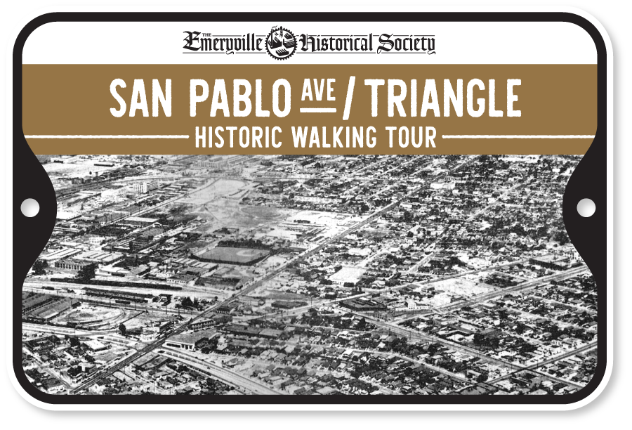
San Pablo Ave / Emeryville Triangle
This self-guided walking tour will detail the stories along one of the East Bay’s oldest corridors that served as a central artery through the region that is a relic of the Spanish Colonial era that was subdivided by the Peralta family.
Today, this stretch of San Pablo Avenue remains a layered historical landscape, reflecting Emeryville’s transformation from industrial outpost and entertainment hub into a post-industrial city shaped by redevelopment, housing, and adaptive reuse.
Take the tour on your mobile device by downloading the STQRY Guide App available on the Apple App Store or Google Play.
- Download STQRY Guide app.
- Search “Emeryville.”
- Download & Start the tour (enable location feature for an optimized experience).
- Navigate to each stop.
Printable tour map below.
Fullscreen ModeThis tour sponsored by:

San Pablo Avenue & Emeryville Triangle Walking Tour
All stories written and edited by Rob Arias and Donald Hausler.
01 – Santa Fe Railroad Depot (Now The East Bay Bridge Shopping Center)
What is now the East Bay Bridge Shopping Center, anchored by Target, Home Depot and the Pak ‘N Save Grocery Store, was once the preeminent transportation gateway of the East Bay …
02 – The National Biscuit Company (Now The Andante Condos)
The southeastern corner at 40th & San Pablo Ave was first developed for The National Biscuit Company in 1912. The National Biscuit Company was the precursor to Nabisco, best known for its Ritz cracker and Oreo Cookie …
03 – Santa Fe Club (Now The Andante Condos)
Emeryville’s position as a transportation hub helped push development along the San Pablo Avenue corridor, with many businesses catering to the workers and travelers of the nearby Santa Fe Depot and Key System lines …
04 – Key Club & Hotel (Now The Andante Condos)
Development along this stretch of San Pablo Avenue began to intensify shortly after passenger rail service reached the nearby Santa Fe Depot, spurring commercial activity in the surrounding area …
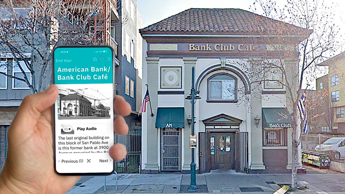
05 – The American Bank Building (Now Bank Club Café)
The last original building on this block of San Pablo Avenue is this former bank at 3900 San Pablo Avenue occupied by the Bank Club Café with Wally’s Cafe tucked away in the rear …
06 – The Hotel Ritz (Now Avalon Senior Housing)
The Avalon Senior Housing complex, built in 1999, sits on what was once the modern Hotel Ritz that stood for nearly 70 years. The three-story brick hotel that opened in 1929 at 3872 San Pablo Avenue was designed by notable architect …
07 – Syndicate Bank Building (Now Avalon Senior Housing)
Among Emeryville’s many lost historic structures, few were as distinguished as the flatiron-shaped Syndicate Bank building that once stood at 3850 San Pablo Avenue. Occupying the triangular gore formed by the intersection …
08 – J. F. Stoer’s Block
This block of San Pablo Ave bordered by West MacArthur and Peralta was settled by the Stoer Family in 1878. Johann Friedrich Stoer, a German immigrant, moved with his wife Carolina Heimerdinger and their family …
09 – Stoer Family Estate
On this corner of San Pablo Avenue and Adeline Street once stood the Stoer family estate, home to one of the families most closely associated with Emeryville’s founding …
10 – 3601 – 3645 San Pablo Avenue
The western side of the 3600 block of San Pablo Avenue is rich with layered history spanning more than a century, and remarkably, many of its original buildings still stand today …
11 – 3600 San Pablo Avenue
This corner at 36th & San Pablo Avenue has lived many lives over the past century: A bootlegging joint, a card room, a barbecue spot, a food pantry and now an affordable housing project …
12 – 3620 San Pablo Avenue
Auto dealerships began spreading rapidly across the American landscape in the years following World War I, driven by a convergence of mass production, installment credit, and changing urban land-use patterns …
13 – The Golden Gate Building – 3706 San Pablo Avenue
Completed around 1946, the brick commercial structure spanned addresses 3706 through 3722 San Pablo Avenue and would go on to house a wide variety of businesses over the next several decades …
14 – West MacArthur Underpass
Built to serve Bay Bridge traffic before freeways existed, the West MacArthur Underpass reflects a pivotal moment when local opposition reshaped East Bay transportation planning …
15 – Cozzens Ball Motor Co.
The rise of automobile use in the early 20th century transformed San Pablo Avenue, the East Bay’s primary north–south route, into a corridor lined with garages, repair shops, parts stores, and service stations …
16 – 3900 Adeline Street
Like many of the buildings on this tour, the story of 3900 Adeline is filled with stories of vice that give “The Rottenest City” its name. The first reference to 3900 Adeline goes back to 1920 when it was Nebel’s Garage owned …
17 – Key System Tower 3 / Moon’s Chinese Kitchen
Here facing the aptly named Key Route Lofts at Adeline and Yerba Buena was once one of the most important junctions in the fabled Key System electric streetcar system. An operator was positioned in the small tower where …
18 – National Upholstering Co.
This brick warehouse, straddling the Emeryville–Oakland border and now home to City Storage, was originally built in 1920 for the Johnson Washer Company. Founded in 1902 by Chris P. Johnson, the company …
19 – Adeline & Linden Street Rail Corridors
You don’t have to look very hard to see how railroads shaped this part of Emeryville and North Oakland. Their influence remains embedded in the street grid, the scale of former industrial buildings now converted to loft …
20 – Aluminum Cooking Utensil Co.
In 1924, the Aluminum Cooking Utensil Company, a subsidiary of the Aluminum Company of America, announced it had purchased this entire block of Adeline Street–bordered by 45th & 46th St.–from the nearby Remar Baking …
21 – The Remar Baking Company
Now known as the Bakery Lofts, this former industrial bakery straddled the Emeryville–Oakland border and operated for nearly 70 years. At its peak, it produced an estimated 1.5 million loaves of bread per month …
22 – Temescal Creek
Where you’re standing, Temescal Creek once flowed openly from the North Oakland Hills westward toward San Francisco Bay. For thousands of years, the creek shaped the landscape, providing fresh water, food, and …
23 – Del Monte Cottages
These rows of humble wood-frame cottages at 1034–1043 48th Street are among the last surviving artifacts of one of Emeryville’s largest and longest-running industries, which shaped the city for more than seven decades …
24 – Church of Christ (Emeryville’s “First” Church)
For decades, Emeryville carried a notorious reputation as a “Godless” town—mocked as “the city without a church or a graveyard.” Unlike neighboring Oakland and Berkeley, it lacked permanent religious institutions …
25 – The East Bay Auto Camp (Now The ECCL)
This large swath of land between 53rd and 47th Streets, straddling the Emeryville–Oakland border, was once home to an “auto camp”, a popular and affordable way for middle-class Americans to explore the country by car…
26 – Emery Unified School District
The Emeryville Center for Community Life (ECCL), completed in 2016, is an ambitious facility that consolidated Emeryville’s previously scattered schools under a single roof. The journey of Emeryville’s school system dates back to April 21, 1884 …
27 – South Berkeley Creamery (Berkeley Farms)
Today, the former Berkeley Farms headquarters at 4550 San Pablo Avenue is home to Escuela Bilingüe Internacional, a Spanish immersion school—an unassuming building that once anchored one of California’s most iconic dairy brands …
28 – Veterans’ Memorial Building (Now The Emeryville Senior Center)
Today, the Emeryville Senior Center at 4321 Salem Street is a regional destination for older adults, offering meals, health and wellness programs, educational activities, trips, and a vital place for social connection …
29 – Emeryville’s Fire Station No. 1
Where you’re standing is roughly the site of Emeryville’s first fire station, which served the community from 1910 until the early 1960s. After Emeryville incorporated in 1896, the town had no fire station of its own, relying instead on nearby Oakland for protection…
30 – Ravazza’s & The Corona Club
When the Oakland Oaks built their ballpark along nearby Park Avenue in 1913, this stretch of San Pablo Avenue transformed almost overnight. What had been a fairly ordinary commercial strip became a lively pre- and post-game promenade …