


A Brief History of Peabody Lane
By Richard D. Ambro. Ph.D.
Few residents of Emeryville have ever heard of Peabody Lane, yet this street is 140 years old and was one of Emeryville’s first.
In the early Gold Rush, there were only a few trails leading to sparsely scattered homesteads, or the trail from Vicente Peralta’s house to the wharf at the mouth of Temescal Creek.
In 1852, newly-constituted Alameda County hired Julius Kellersberger to layout a new road from 14th Street and Broadway in Oakland, all the way to San Pablo in Contra Costa County. This road, today’s San Pablo Avenue, passed through what is now Emeryville.
In an age when all land transport of goods and people was by horse-drawn wagon over roads that were dusty in summer and turned to muddy, rutted byways in winter, it was important to shorten distances traveled. Soon a number of wharves were built along the shore of today’s Berkeley, Emeryville, and Oakland. One of these was Peabody’s wharf.
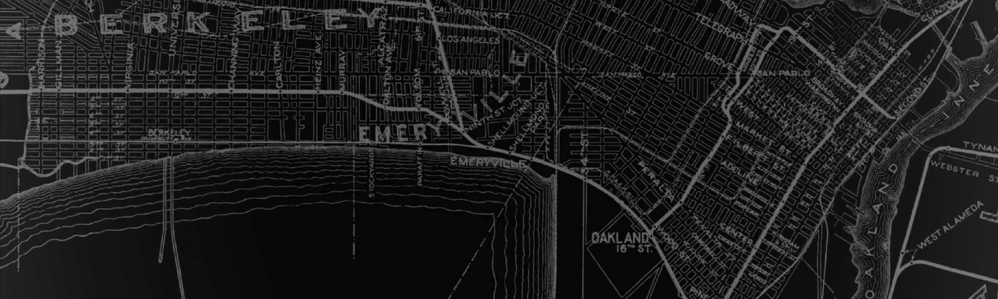
This vintage 1920 Thomas Bros. map shows Peabody Lane when it extended all the way to the shoreline (raremaps.com).
Peabody’s Landing
John Allen Peabody was a sailor who apparently arrived in California in 1851. During the Gold Rush, he built his wharf on the shore of what is today northwest Emeryville. By 1857, he maintained at least one warehouse at “Peabody’s Landing.”
The dirt trail leading to the wharf from the San Pablo Road, running at a slight angle from nearby property lines, soon came to be known as Peabody’s Lane. Peabody’s wharf was spotted on maps of the late 1850s, 1860s, and 1870s, serving the farmers and residences of the north Oakland-South Berkeley area.
In the mid-1870s, the Northern Railway (later the Southern Pacific) extended its tracks along the shoreline of today’s Emeryville, crossing the western end of Peabody’s Lane.
In the late 1870s, a stockyard, butchering. and meat packing district developed between the tracks and the bayshore in northeast Emeryville. This area came to be known as Butchertown, and it soon engulfed Peabody’s Landing.
By the tum of the century, Peabody’s Lane ended on the east side of the tracks and was lined by farmsteads and stockyards. Presumably. stock could still be herded across the tracks to the slaughterhouses on the west. By mid-20th century, Butchertown had declined and the area shifted to warehouses and light industry.
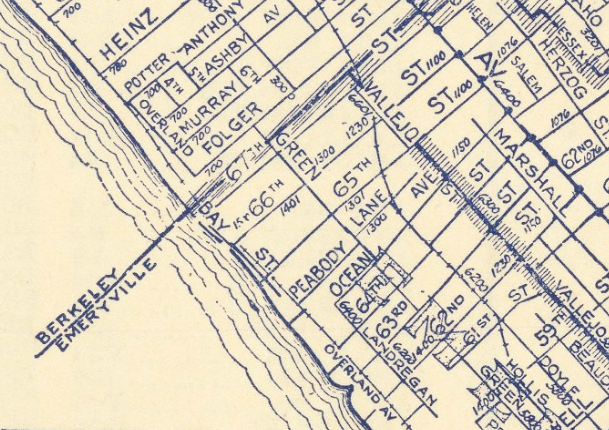
Peabody Lane
Today, the historic trail to Peabody’s wharf survives unnoticed as Peabody Lane, a short, narrow alley running between Ocean Avenue and 65th Street, only half its original length. It lies on the west side of San Pablo Avenue in north Oakland, between Ocean Avenue and 65th Street. The lane still runs at its old angle west into Emeryville toward the Bay. between the backyard fences and garages of modest residences facing Ocean Avenue and 65th Street, and past the Peabody Lane Warehouse at 1170 Peabody Lane.
The alley now ends just east of Doyle Street. Farther west, it survives as the access driveway behind buildings of the light industrial/warehouse district. It then crosses Hollis Street. and continues westward as the driveway on the south side of the Ryerson Steel company, ending at the Southern Pacific tracks. The old wharf area now lies buried under fill and apartment buildings to the west of the tracks and Bay Street. Yet, looking down the alley from San Pablo Avenue, it’s easy to picture the wagons of the Gold Rush era hauling freight from the long-vanished wharf at Peabody’s Landing.
This story originally published in 1996 for the Emeryville Centennial Celebration and compiled into the ‘Early Emeryville Remembered’ historical Essays book.
Feature Image: mapsofthepast.com
Kate Lucchese
We live on Ocean Ave around the corner from Peabody Lane, and walk/drive it all the time. It has a serene, timeless quality, outside the usual rules of house numbers, sidewalks, and street widths. Now I see it is just dreaming on its past.